Ausangate Trek 4 Days
- 4 Days
- 3 Nights
- Demanding
- Trekking
- Around Ausangate, Cusco
Trek for four days through the high Andes below Ausangate, the highest peak in the Cusco region: glacial lakes, alpaca herds, remote communities and passes close to 5,000 m.
Trip facts
- Duration 4 Days / 3 Nights
- Difficulty Demanding
- Max altitude 5,000 m / 16,404 ft
- Best season May to September
- Meals Included on the trek (confirmed with your quote)
- Accommodation Camping (3 nights; some routes use basic shelters)
- Transportation By road to and from the trailhead
- Guide Local trekking guide
Overview
Ausangate is the highest mountain in the Cusco region, at about 6,384 m (20,945 ft), and one of the most sacred peaks in the southern Andes. Every year, thousands of pilgrims gather in the mountains nearby for the Qoyllur Rit’i festival, and the herding families who live on its slopes still make offerings to the mountain. A trek around Ausangate takes you through some of the wildest, highest landscapes you can walk in Peru: glaciers, lakes of turquoise and red, wide valleys dotted with alpacas and passes close to 5,000 m.
This is not an easy trek, and we won’t pretend it is. The whole route stays above roughly 4,000 m (13,100 ft), nights are well below freezing in the dry season, and each day includes at least one serious climb. There are no roads or villages with services along most of the way, just stone corrals, small herding settlements and your camp. It’s best for experienced hikers who are already acclimatized and comfortable with cold, basic conditions.
In return you get solitude and scale. On most days you’ll see more alpacas than people. The Quechua-speaking communities of the area, around places such as Tinki, Upis and Pacchanta, live from herding and weaving, and local horsemen usually travel with trekking groups and carry the camping gear. Routes vary between operators: some circle part of the massif through its highest passes, others finish at Rainbow Mountain. We confirm your exact route, campsites and highest point with your quote.
If you’d like a taste of Ausangate without camping, our 7 Lakes of Ausangate day hike explores the lakes near Pacchanta in a single, long day from Cusco. To compare it with our other multi-day routes, see our Cusco treks.
Highlights
- Trek below Ausangate, at about 6,384 m the highest peak in the Cusco region
- Cross high passes close to 5,000 m with glaciers all around
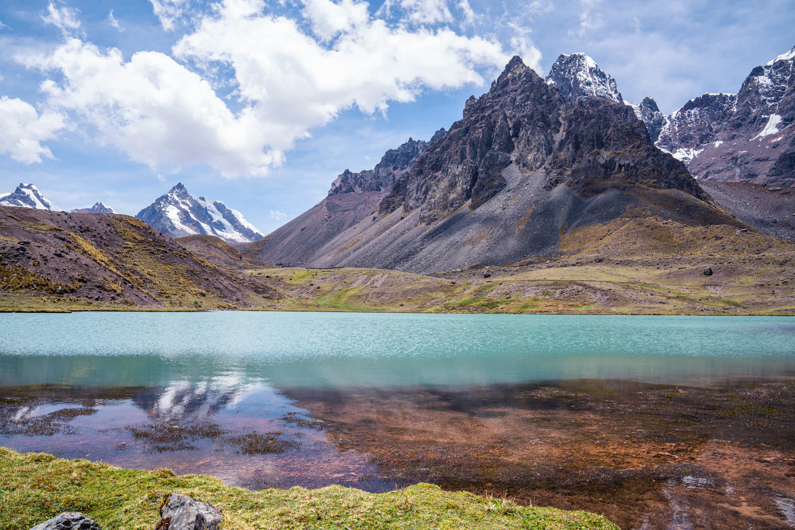
- Camp beside glacial lakes of turquoise, blue and red
- Walk through the pastures of Quechua herding communities, with alpacas and llamas
- Some routes finish at Rainbow Mountain, reached from the quiet side
- Solitude: far fewer trekkers than on the routes to Machu Picchu
Itinerary
Day 1:
Cusco to the Ausangate highlands
A drive of about three hours to the trailhead, then a first afternoon on foot to camp below the glaciers.We pick you up early in Cusco and drive southeast toward Ocongate, climbing into the wide, high valleys of the Ausangate area. After meeting the horsemen who travel with the group, you start walking across open grassland, with the mountain growing larger ahead of you. The first day is deliberately moderate, to help you adjust, and ends at a camp high in the valleys below the glaciers.
- Starts
- Cusco
- Ends
- First camp
- Meals
- Lunch and dinner
- Accommodation
- Camping or basic shelter
Temperatures drop fast after sunset. Put on warm layers before you feel cold.
Day 2:
First high pass and glacial lakes
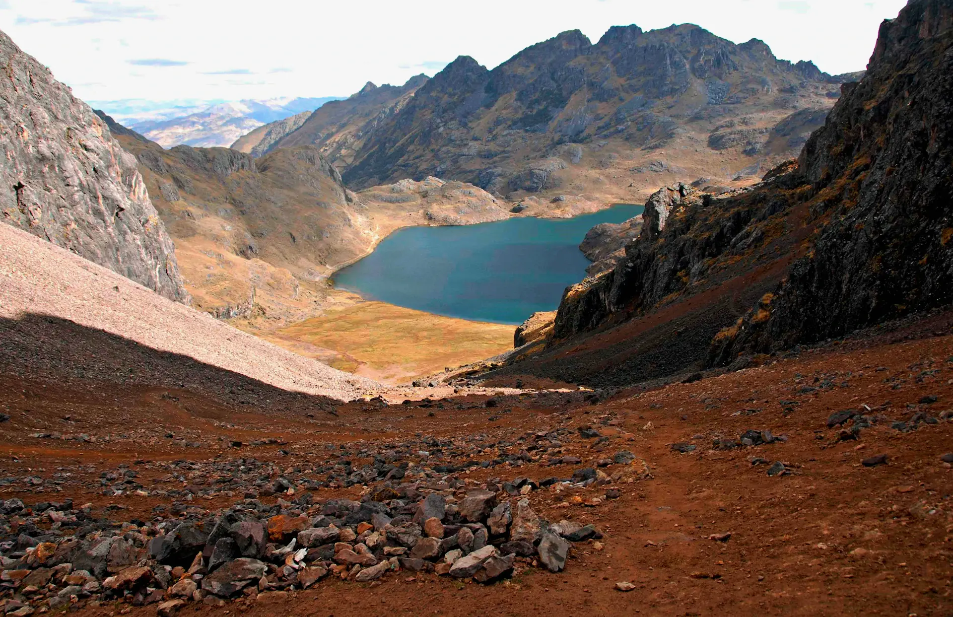
A climb to the first high pass of the route, then a descent past glacial lakes to the next camp.After a hot breakfast, you climb toward the first high pass, where the glaciers of Ausangate come close enough to see their crevasses. The descent on the other side leads past lakes whose colors change with the light and the minerals in the water, from milky turquoise to deep red. Herders often move their alpacas and llamas across these slopes, and your guide can tell you about daily life in the area.
- Starts
- First camp
- Ends
- Second camp
- Meals
- Breakfast, lunch and dinner
- Accommodation
- Camping or basic shelter
Day 3:
The highest pass of the trek
The toughest day: a long climb to the highest pass of the route, close to 5,000 m, and on to the last camp.The third day usually crosses the highest point of the route. Depending on the itinerary, this is a pass close to 5,000 m or, on some routes, around 5,200 m. The climb is slow and steady, with frequent stops to breathe, and the reward is a wide view over glaciers, jagged ridges and valleys of striped mineral earth. The last camp is set among the peaks, and it’s often the coldest night of the trek.
- Starts
- Second camp
- Ends
- Third camp
- Meals
- Breakfast, lunch and dinner
- Accommodation
- Camping
Your guide may change the route or pace for weather or group health. Safety comes first at this altitude.
Day 4:
Final descent and return to Cusco
A last morning walk, on some routes via Rainbow Mountain from its quieter side, and the drive back to Cusco.The final morning is usually shorter. On routes that finish at Rainbow Mountain, you approach Vinicunca’s striped slopes from the less crowded side before most day visitors arrive; on other routes you descend through the valleys to a village. A vehicle meets you at the end of the trail for the drive back to Cusco, arriving in the late afternoon or evening.
- Starts
- Third camp
- Ends
- Cusco
- Meals
- Breakfast and lunch
What’s Included
Included
- Local trekking guide
- Transportation from and back to your hotel in Cusco
- Camping equipment and a trek cook (details confirmed with your quote)
- Meals on the trek, as listed in your confirmed itinerary
- Horsemen and pack animals to carry the camping gear
Not included
- Community fees and site tickets on the route, unless shown in your quote
- Sleeping bag and trekking poles (available to rent)
- Riding horse, if you want one
- Travel insurance, strongly recommended for high-altitude trekking
- Tips for your guide, cook and horsemen
Route, campsites, highest point, meals and every inclusion are confirmed in writing with your quote.
What to Bring
Documents
- Passport or a copy, and travel insurance details
- Cash in Peruvian soles for community fees and tips
Clothing
- Waterproof hiking boots with ankle support, well broken in
- Thermal base layers, fleece and a warm down or synthetic jacket
- Warm hat, buff and insulated gloves
- Waterproof jacket and trousers
Gear
- Sleeping bag rated to at least −15 °C (5 °F), your own or rented
- Trekking poles
- Headlamp with spare batteries
- Water bottles (2 liters) and a way to carry snacks
Health & personal
- High-SPF sunscreen, glacier-grade sunglasses and lip balm
- Personal first-aid kit, blister care and any altitude medication your doctor recommends
Food, Lodging & Transport
Food & meals
The trek cook prepares hot, filling meals at camp and a packed or hot lunch on the trail, with plenty of hot drinks: at this altitude and temperature, warm food and fluids make a real difference. Tell us about any dietary needs when you book. The meals included on the first and last days are confirmed with your quote.
Accommodation
This is a camping trek, with campsites between roughly 4,300 and 4,900 m (14,100 to 16,100 ft), often beside a lake or below a glacier. Some routes use basic community-run shelters for one or more nights. Expect cold nights, well below freezing in the dry season, and simple facilities. We confirm the campsites and shelters with your quote.
Transportation
The trailhead is about three hours southeast of Cusco by road, in the area around Tinki and Ocongate. At the end of the trek, a vehicle meets you at the finishing point, which depends on the route, and drives you back to Cusco.
Difficulty & Altitude
- Difficulty
- Demanding
- Highest point
- 5,000 m / 16,404 ftHighest pass: about 5,000 m, up to about 5,200 m on some routes
Fitness
We rate the Ausangate trek as demanding. Daily walking times are typically five to eight hours, on paths that are often faint, rocky or boggy, with climbs to passes near 5,000 m. The distances aren’t extreme; the altitude, the cold and the remoteness are what make it hard.
You should have multi-day trekking experience, ideally including time at altitude, and be in good physical shape. Serious training, with long hikes and hill work, is recommended. If you’re new to trekking, the Salkantay or Lares routes are better first choices.
Altitude
The entire trek is high. Most routes start around 3,800 to 4,300 m (12,500 to 14,100 ft), camp between about 4,300 and 4,900 m and cross passes close to 5,000 m, with some routes reaching around 5,200 m (17,000 ft). There’s little chance to drop lower if you feel unwell, so preparation matters.
- Acclimatize properly. We recommend at least three or four nights in Cusco or the Sacred Valley first, including a high day hike such as Humantay Lake or the 7 Lakes.
- Know the symptoms. Severe headache, vomiting, confusion or unusual breathlessness at rest are serious signs, and the only reliable treatment is to descend.
- Talk to your doctor. Ask about altitude medication before your trip.
Permits, Tickets & Rules
- No government trekking permit. There’s no national permit quota for Ausangate.
- Community fees. The communities whose land the route crosses charge entrance fees, collected along the way. Routes that finish at Rainbow Mountain also pay its community fee.
- Respect local life. The pastures and corrals are people’s homes and workplaces. Ask before taking portraits, keep a distance from the herds and follow your guide’s lead when you meet families on the trail.
Traveling with Family
We don’t recommend the Ausangate trek for children. The altitude, the cold and the remoteness make it a serious undertaking even for experienced adults. Older teenagers with real trekking experience at altitude may be able to join, and we’d want to talk it through with you first.
For families, the 7 Lakes day hike or a relaxed Sacred Valley itinerary gives a taste of the high Andes with far less risk.
Frequently Asked Questions
How high does the Ausangate trek go?
The highest passes are close to 5,000 m (16,400 ft), and some routes reach around 5,200 m (17,000 ft). Camps are between roughly 4,300 and 4,900 m. We confirm the highest point of your route with your quote.
How cold are the nights?
Very cold. In the dry season, nights are regularly well below freezing at camp. A warm sleeping bag, a down or synthetic jacket and a warm hat are essential.
Do we sleep in tents or shelters?
Mostly in tents. Some routes use basic community-run shelters for one or more nights. We confirm the setup for your dates.
Is Rainbow Mountain included?
It depends on the route. Some 4-day routes finish at Rainbow Mountain, approaching it from the quieter side; others don’t. Tell us if it matters to you and we’ll plan accordingly.
How is this different from the 7 Lakes day hike?
The 7 Lakes hike is a single long day near Pacchanta, returning to Cusco the same evening. The Ausangate trek spends four days crossing high passes and camping in remote valleys.
What if I get sick on the trail?
Your guide monitors the group throughout and carries a first-aid kit. If someone shows serious signs of altitude sickness, the plan is to descend, using horses if needed. Good travel insurance is essential for this trek.
Is the Ausangate trek right for me?
If you’ve done multi-day treks before, enjoy remote places and handle cold well, yes. If this would be your first trek at altitude, we’d suggest starting with the Salkantay route or a day hike first.
Route
Route map coming soon
Route at a glance
- Cusco, about 3,400 m (11,150 ft)
- Trailhead in the Ausangate area (Tinki, Upis or Pacchanta, depending on the route)
- Glacial lakes and camps, about 4,300–4,900 m
- High passes, close to 5,000 m
- Finish point (on some routes, Rainbow Mountain)
- Back to Cusco
Routes circle part of the Ausangate massif, about 100 km southeast of Cusco. The exact route, passes and finish point are confirmed with your program. A route map and elevation profile are being prepared.
Tour Video
Our video for this tour is coming soon. Until then, we’re happy to answer your questions on WhatsApp or by email.
Travel Tips for This Trip
Why DSL Adventures
Planned by a Local Team in Cusco
-
Based in Cusco
Your trip is planned by people who live here and know the region’s seasons, roads and trails.
-
Local Guides
Guides from the region who know the trails, the history and the communities along the way.
-
Direct Communication
One conversation with the team organizing your trip, from your first question to your last day.
-
Personalized Planning
Dates, pace and details shaped around your group.
-
Visual Storytelling
Photos and stories from our routes help you picture each day before you go.
- Full Day Day Hike
Cusco to Pacchanta and the Ausangate lakes
7 Lakes of Ausangate 1 Day
A full-day loop past glacial lakes of different colors below Ausangate, starting in the highland village of Pacchanta. Quieter than Rainbow Mountain.
Price On request 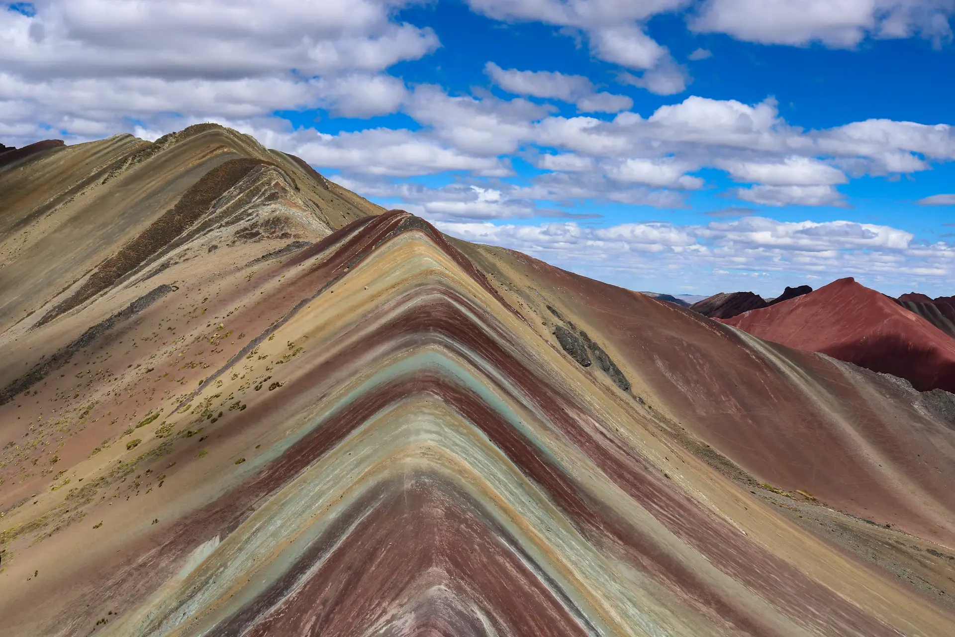 Full Day Day Hike
Cusco to Vinicunca
Rainbow Mountain 1 Day
A short but very high hike to the striped slopes of Vinicunca, at about 5,000 m. An early start, a slow climb and big views of the Vilcanota range.
Price On request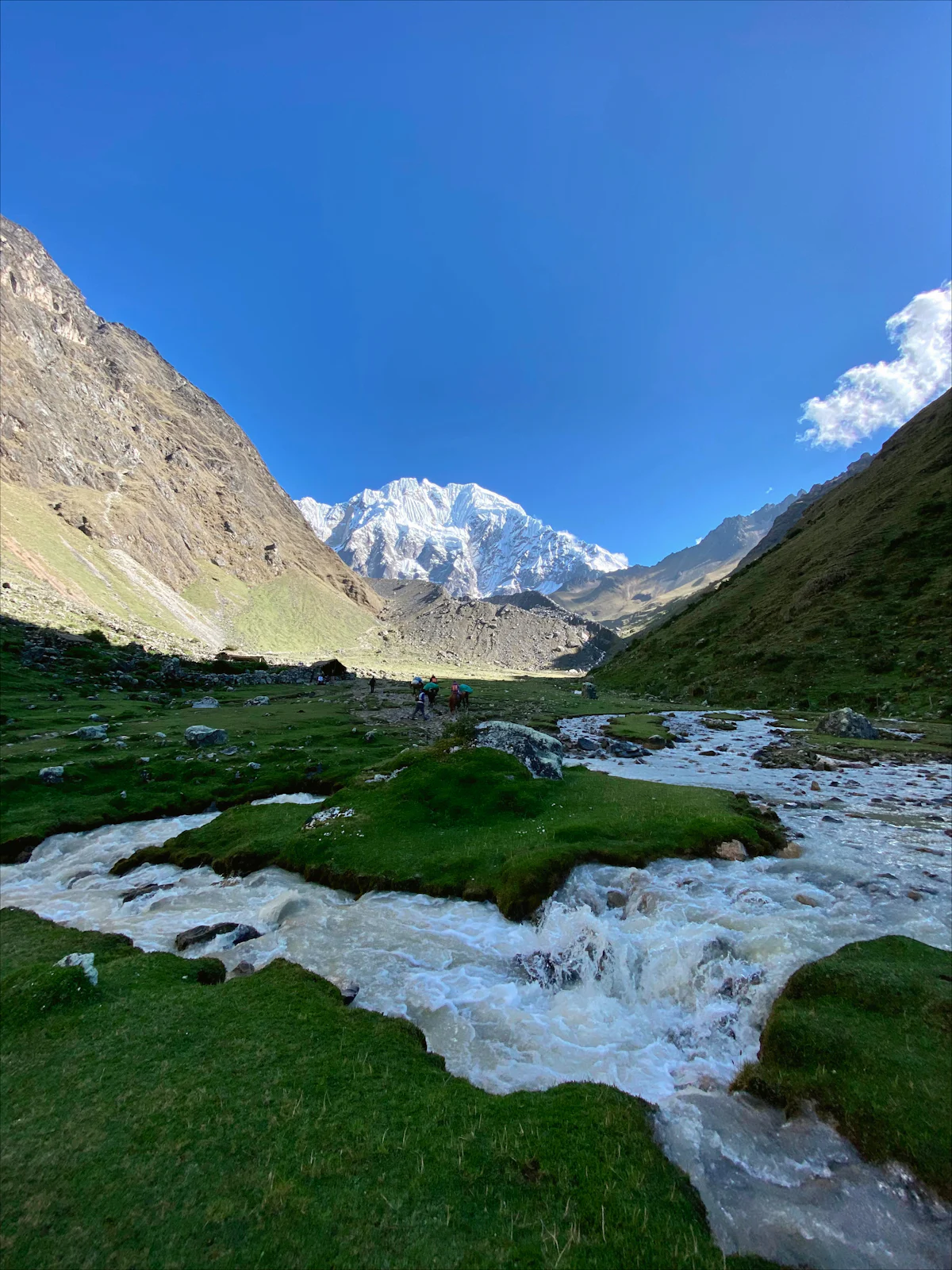 5 Days Trek
Salkantay and Llactapata to Machu Picchu
Salkantay Trek 5 Days
The full-paced Salkantay route: the same high pass, then two shorter days through coffee country and over Llactapata, with a first view of Machu Picchu.
Price On request
Plan your trip
Let’s Plan Your Trip Together
Tell us your dates, who’s traveling and what you’d like to see. Our team in Cusco will reply with availability, ideas and clear next steps.